
Google Maps is not just a handy tool for finding directions or discovering new places; it also serves as a powerful source of information about global trends and events. One fascinating use of Google Maps is to analyze patterns and gather insights about geopolitical situations. In particular, the tracking of Russian military movements has become an intriguing subject of study using this mapping service. By analyzing satellite imagery and monitoring changes in military bases, transportation routes, and troop movements, experts have been able to decipher certain aspects of Russia’s strategic intentions. In this article, we will delve into how Google Maps can provide valuable information about the Russian invasion, shedding light on the motivations behind their actions and offering an unprecedented view of global geopolitics.
Inside This Article
- Use of Satellite Imagery
- Tracking of Military Movements
- Analysis of Border Changes
- Impact on Civilian Population
- Conclusion
- FAQs
Use of Satellite Imagery
Satellite imagery has revolutionized the way we understand and analyze the world, offering invaluable insights into various fields, including the tracking of military movements. By utilizing satellite technology, we are able to gain access to high-resolution images of strategic locations and monitor activities from a bird’s-eye view. This has proven to be an indispensable tool in understanding geopolitical events, such as the Russian invasion, and assessing their implications.
One of the key advantages of using satellite imagery is the ability to observe areas that are inaccessible or hostile to human presence. In the context of the Russian invasion, this technology allows us to closely monitor the movements of military forces in remote regions, providing valuable data for analysis. By tracking troop deployments, equipment positioning, and infrastructure development, we can gain crucial insights into the intentions and strategies of the invading forces.
Moreover, satellite imagery enables us to detect changes in the environment, giving us a comprehensive understanding of the impact of the invasion on the landscape. By comparing images taken before and after the invasion, we can identify alterations in borderlines, the destruction of infrastructure, and changes in land use patterns. This data is vital for assessing the extent of the invasion and its potential long-term consequences.
Furthermore, satellite imagery plays a crucial role in assessing the impact of the invasion on the civilian population. By analyzing the movement of displaced individuals, identifying refugee camps, and monitoring humanitarian assistance efforts, we can gain insights into the humanitarian crisis caused by the invasion. This information is vital for coordinating relief efforts, providing aid to those in need, and advocating for international assistance.
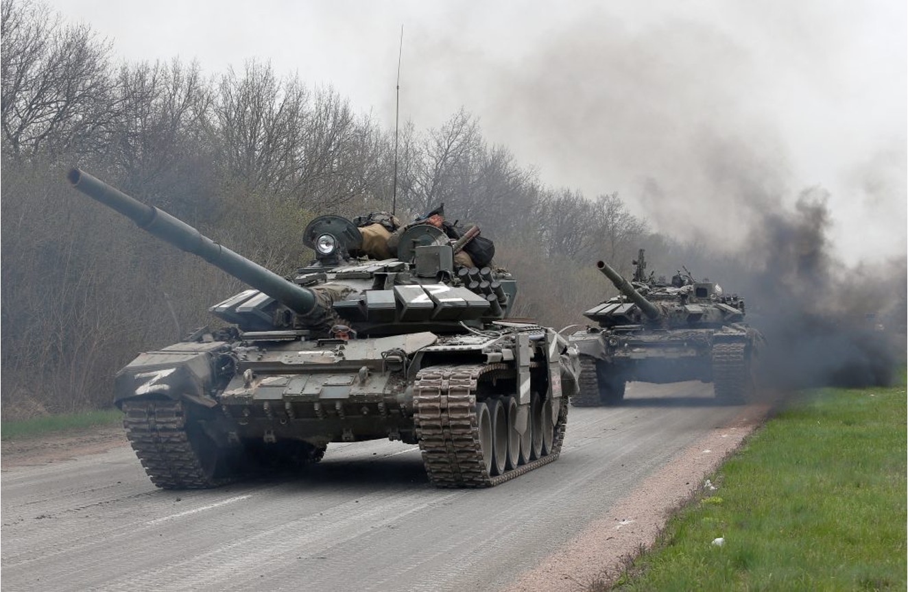
Tracking of Military Movements
One of the most fascinating and useful features of Google Maps is its ability to track military movements. Through the use of satellite imagery and other advanced technologies, Google Maps can provide invaluable information about the movement of troops, vehicles, and other military assets.
By monitoring these movements, analysts and researchers can gain insights into potential military conflicts, identify potential hotspots, and even make predictions about future conflicts. This information can be crucial for governments, intelligence agencies, and military strategists in developing their defensive and offensive strategies.
Google Maps allows users to zoom in on specific locations to get a detailed view of military installations, training grounds, and other areas of interest. By combining this information with other sources such as news reports and intelligence reports, a more comprehensive understanding of military dynamics can be achieved.
Furthermore, Google Maps can also provide real-time tracking of military movements. This can be particularly useful during times of crisis or conflict, allowing relevant parties to monitor the actions of opposing forces and respond accordingly. This feature can help prevent surprises, facilitate rapid responses, and enhance situational awareness.
In addition, Google Maps can be used to analyze patterns of military movements over time. By reviewing historical satellite imagery and tracking data, analysts can identify trends, detect changes in troop deployments, and assess the overall strategic posture of a military force.
Overall, the tracking of military movements through Google Maps is a powerful tool that provides valuable information to governments, intelligence agencies, and military personnel. Its ability to provide real-time tracking, analyze historical data, and offer insights into potential conflicts makes it an indispensable resource for understanding the ever-evolving dynamics of national security.
Analysis of Border Changes
One significant aspect of using Google Maps for analyzing the Russian invasion is the capability to track changes in borders. By comparing satellite imagery over time, it becomes possible to identify modifications in the physical boundaries of regions affected by the conflict.
Google Maps provides high-resolution satellite images that offer a detailed view of the affected areas. Analysts can zoom in on specific locations to examine the before and after pictures, allowing for a comprehensive understanding of the border changes that have taken place.
These border changes can be critical in understanding the progress and objectives of the Russian invasion. They enable experts to assess the expansion of Russian-controlled territory, the regions under dispute, and the potential impact on neighboring countries.
Furthermore, Google Maps allows for the overlay of additional data, such as political and administrative boundaries. This feature enables analysts to compare the altered borders with the legal and recognized boundaries, highlighting any violations or territorial disputes that may arise.
By analyzing the border changes using Google Maps, experts can gain valuable insights into the motivations and strategies behind the Russian invasion. It provides a visual representation of how the conflict has reshaped the geopolitical landscape in the region.
The analysis of border changes also aids in predicting potential future movements. By closely monitoring the shifting boundaries, analysts can anticipate the potential next targets or areas of conflict, enabling better preparedness and response from both local and international entities.
Impact on Civilian Population
The Russian invasion has had a devastating impact on the civilian population. From the initial stages of the invasion, innocent men, women, and children have been caught in the crossfire, facing immense danger and displacement.
As the conflict continues, the civilian infrastructure has suffered significant damage. Homes, schools, hospitals, and other essential facilities have been destroyed, leaving thousands without access to basic necessities and healthcare services.
Furthermore, the invasion has led to the displacement of large numbers of civilians. Many families have been forced to flee their homes, seeking refuge in neighboring countries or within their own nation. This mass exodus has created a humanitarian crisis, with overcrowded refugee camps and limited resources.
With the disruption of vital supply chains and the destruction of agricultural areas, food and water shortages have become rampant. The civilian population is facing severe struggles to access basic sustenance, leading to malnutrition and other health issues.
The psychological impact of the invasion on the civilian population cannot be underestimated. Witnessing the destruction of their communities and the loss of loved ones has left lasting scars on the mental well-being of those affected. PTSD, anxiety, and depression are widespread among the survivors.
Children are particularly vulnerable in this conflict. Many have been separated from their families, exposed to violence, and deprived of education. The future of these children is at risk as they continue to face the consequences of the invasion.
International aid organizations have been working tirelessly to provide assistance to the affected civilian population. Humanitarian aid, including food, medical supplies, and shelter, is being distributed to the most vulnerable. Efforts are also being made to establish safe zones and facilitate the return and resettlement of displaced civilians.
Despite these efforts, the lasting impact of the Russian invasion on the civilian population will be felt for years to come. Rebuilding homes, restoring infrastructure, addressing mental health issues, and ensuring access to basic needs will require extensive resources and long-term commitment.
The international community must come together to support the affected civilian population and work towards a sustainable solution that brings stability and peace to the region. Only through collective efforts can we hope to alleviate the suffering and restore the lives of those impacted by this devastating conflict.
Conclusion
In conclusion, Google Maps has revolutionized the way we navigate and explore the world around us. This powerful mobile app has not only made it easier for us to find our way from point A to point B, but it has also provided us with valuable insights and information about the places we visit. From real-time traffic updates to user-generated reviews and ratings, Google Maps has become an indispensable tool for both locals and travelers alike.
With its comprehensive database and constantly evolving features, Google Maps has become an invaluable resource for businesses as well. From optimizing their locations to reaching new customers through targeted advertising, businesses can leverage the power of Google Maps to enhance their online presence and attract more customers.
Whether you’re looking for the best route to your destination, exploring new places, or discovering local businesses, Google Maps has become an indispensable companion in our daily lives. Its accuracy, convenience, and user-friendly interface make it a go-to app for millions of people around the world. So, next time you’re setting out on an adventure or simply trying to find a nearby restaurant, be sure to turn to Google Maps for all your navigation needs.
FAQs
1. What is Google Maps?
Google Maps is a web-based mapping and navigation service offered by Google. It allows users to explore locations, view maps, get directions, and even discover nearby places of interest.
2. How does Google Maps benefit users?
Google Maps provides a wealth of benefits to users, including real-time traffic updates, turn-by-turn navigation, public transit information, and Street View imagery. It helps users save time, avoid traffic congestion, and explore unfamiliar areas with ease.
3. Can I use Google Maps on my mobile device?
Yes, Google Maps is available as a mobile app for both Android and iOS devices. The app offers all the features of the desktop version, making it convenient for users to access and navigate on the go.
4. Are there any additional features in the Google Maps mobile app?
Absolutely! The mobile app of Google Maps provides additional features like offline maps, which allows users to download maps for offline use in areas with limited or no internet connectivity. It also offers location sharing, where users can share their real-time location with others.
5. Is Google Maps only useful for navigation purposes?
No, apart from navigation, Google Maps has evolved into a comprehensive platform that provides various services. It allows businesses to list and display their information, enables users to review and rate places, and offers a platform for exploring local events, attractions, and customized maps created by users or businesses.