




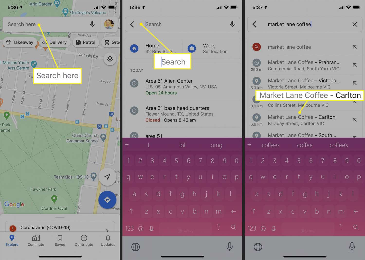
To use Google Maps, open the app on your phone, search for a destination, and tap Directions to choose your travel mode. This core flow works the same on iPhone and Android: search, tap Directions, pick Driving, Transit, Walking, Ride, Cycle, or Motorcycle (Android only), and follow the route.
How to use Google Maps to get directions
- Open the Google Maps app on your iPhone, iPad, Android phone, or Android tablet.
- In the top search box, enter an address, place name, or category like gas stations or groceries.
- Tap a result to see it on the map.
- Tap Directions at the bottom left.
- Choose a travel mode: Driving, Transit, Walking, Ride, Cycle, and on Android also Motorcycle.
- If alternate routes appear in gray on the map, tap the gray line to switch to that route.
Once you start navigating, follow the on-screen instructions and voice prompts to reach your destination. You can switch travel modes at any time before you start, and the map will recalculate your route instantly.
Getting started with the app
If Google Maps is not already on your phone, download it from the App Store on iPhone or iPad, or from Google Play on Android. After installation, open the app and sign in with your Google account. Signing in lets you save places and sync your activity across devices. When prompted, grant location access so the map can show your current position with a blue dot. This step is essential for accurate directions and nearby place suggestions.
Finding places and businesses
Tap the search box at the top of the screen and type an address, a place name, or a category like gas stations or groceries. As you type, Google Maps suggests matching results. Tap one to drop a marker on the map and see details like the address, hours, and reviews. You can also tap directly on the map to select any point, then use that as your destination. This works identically on iPhone and Android.
Choosing a route and travel mode
After you tap Directions at the bottom left, select your travel mode. The options are Driving, Transit, Walking, Ride, Cycle, and on Android Motorcycle. Each mode shows a different set of routes and estimated travel times. When multiple routes are available, they appear as gray lines on the map. Tap the gray line you prefer to follow that route instead of the default one. The app will then guide you with turn-by-turn navigation for that specific path.
Using map layers for traffic and transit
Tap the Layers button to change what the map displays. You can turn on traffic conditions to see real-time congestion, terrain to view elevation and landforms, biking paths for cyclist-friendly roads, and transit lines for bus and rail routes. These layers work on both iPhone and Android and help you choose the best route based on current conditions. Toggle layers on or off anytime while viewing the map.
Exploring the map interface
On iPhone and iPad, Google documents More for Street View's Tilt to look option. On Android, Google documents More and Tilt to look for Street View as well. Google's help pages also document Show map on feature phones, along with zoom in and zoom out controls, but that page is for feature phones, not iPhone or Android.
Saving offline maps for no-signal areas
To use Google Maps without an internet connection, you must download an offline map beforehand. Tap your profile picture or initial, then select Offline maps. Before you can download, you need an active internet connection. On iPhone and iPad, you must not be in Incognito mode. On Android, you must be signed in to Google Maps. Once downloaded, the offline map works for navigation and searching within the saved area, even when you have no signal.
Frequently Asked Questions
Can I use Google Maps for walking directions?
Yes. Tap Directions, then select Walking as your travel mode. Google Maps will show pedestrian paths, estimated walking time, and turn-by-turn instructions tailored for foot travel.
How do I save a location for later?
Tap a place on the map, then tap the Save button on its details page. You can add it to a list like Favorites or create a custom list. Saved places appear under your profile menu for quick access.
Does Google Maps work in other countries?
Yes, Google Maps provides navigation in most countries worldwide. For areas with poor connectivity, download offline maps before you travel. Some features, like transit schedules, may vary by region.
Can I share my real-time location with someone?
Yes. Tap your profile picture or initial, select Location sharing, and choose a contact or generate a link. You can set a duration for how long your location remains visible.
How do I change the map view to satellite?
Tap the Layers button and select Satellite view. This shows aerial imagery instead of the standard road map.
For the wider topic, see maps and navigation app settings.